
OCTOBER 2020 WATER STORAGE DAM HIGH RESOLUTION 2D IMAGING SONAR SURVEY
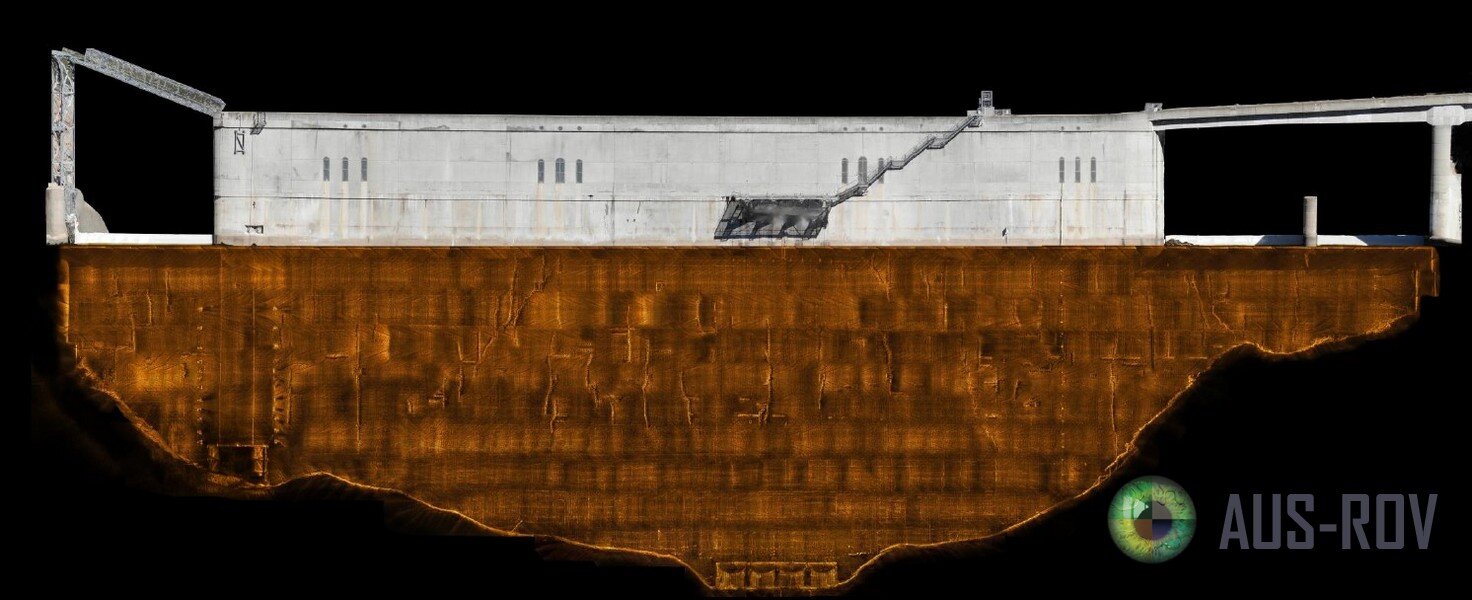
AUS-ROV utilised the Teledyne SeaBotix vLBV300 Remotely Operated Vehicle System to position and survey a dam wall surface using Teledyne BlueView M900/2250 - 130 2D two dimensional high resolution multibeam sonar to detect deviations in surface profile, concrete spalling, cracking, deterioration and condition of previously installed repairs or patchwork. The sonar data is captured and later post processed to achieve a 2D high resolution image of the entire dam wall. A UAV was utilised to capture the above water dam structure in HD Video and this data used to generat a photogrammetric model allowing AUS-ROV personnel to present the entire upstream face of the dam structure in a high resolution 2D hybrid photo mosaic.